
The system is composed by 2 GPS measurement stations + 1 Laser and a Control Unit. The measurement frequencies are 2-4 measurements per day for the GPS, while for the laser it is one measurement every 10 minutes. The cellar modem (GSM) technology is used for the communication between the stations and the Control Unit. The reference station is connected directly to the power supply while the other two stations (mobile GPS station and laser station) are connected to solar panels.
Aim of monitoring:
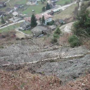
The project aim is to monitor the landslide to control the movements in the three directions and to documents the land movements
| Installation Period | Type of sensors | Number of sensors |
| 2003 | 3DeMoN & GPS | 1 x Laser & 2 x GPS |